Advantages:
- Automates seaweed detection and quantification using satellite imagery
- Combines physics-based models and machine learning for accurate results
- Generates actionable seaweed maps at various spatial and temporal resolutions
- Applicable globally works on both Sargassum and Ulva blooms across different regions
Summary:
Massive seaweed blooms particularly Sargassum and Ulva have increasingly affected coastal regions like the Caribbean, Yellow Sea, and East China Sea. These blooms pile up on beaches and disrupt local ecosystems, tourism, and economies. Traditional detection relies on raw satellite data, which are difficult to interpret and often delayed, limiting response efforts and mitigation planning.
This technology introduces a set of custom algorithms that automatically detect, delineate, and quantify marine macroalgae from satellite imagery. By fusing physical principles with computer intelligence, the system analyzes spatial and spectral anomalies in satellite data to identify seaweed presence. The output includes scalable maps of bloom location and density with flexible resolution. Designed to support real-time environmental response, this system offers powerful tools for governments, environmental agencies, and commercial operations needing early detection and tracking of harmful seaweed events.

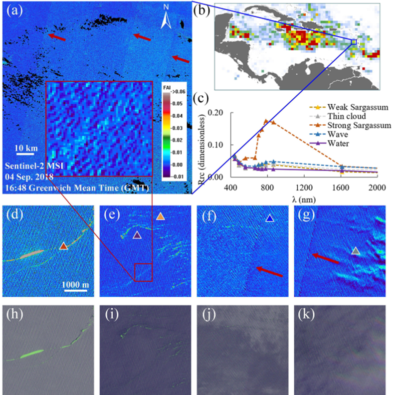
The image showcases automated detection of Sargassum from Sentinel-2 satellite imagery using custom algorithms. It highlights how different features like seaweed, clouds, and waves are separated and quantified to generate accurate seaweed maps.
Desired Partnerships:
- License
- Sponsored Research
- Co-Development